Glamija, village Rtkovo, Kladovo municipality, Bor administrative county
GLAMIJA, FOTRRESS
Regional Institute for the protection of cultural monuments Niš
Glamija fortress village Rtkovo, Kladovo municipality, Bor administrative county
Recorded cultural monument enjoying previous protection; Completing project documentation is under way, in order to initiate the procedure to enlist Glamija into the UNESCO world cultural heritage list, as part of Roman limes.
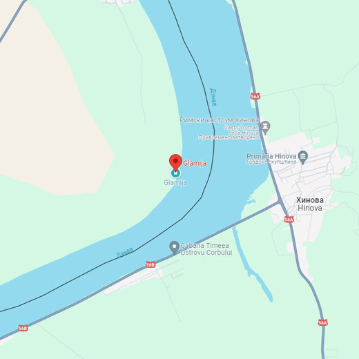
Where is it located?
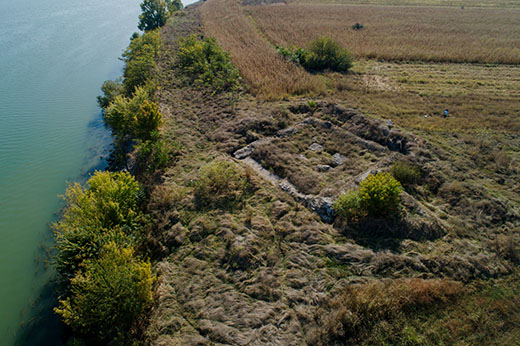
Fortress Glamija in the village Rtkovo is built on the high river terrace on the right bank of the Danube, on the spot where river bends and forms the Danube key, on the easternmost spot of East Serbia, downstream from Kladovo.
History
The remains of the fortification were first noted by Marsili at the end of the 18th century, and they were also mentioned by Felix Kanitz in the late 19th century. Archaeologist M. Vasić researched the prehistoric necropolis in the vicinity of the fortress in 1910, but does not mention this fortress.
The first research of the fortress was conducted in 1980-1982, when the foundations of the small fortification were discovered, with another, somewhat younger, rampart. The older fortification was built in the second half of the 4th century, as documented by coins of Roman rulers. The younger phase was determined to be in the first half of the 6th century.
In 2020, research and conservatory work was started anew in the frame of the project of defining the fortress of the Danube limes and preparing the documentation for further protection.
The research indicates that such a small fortification had the function of a watch tower. It was destroyed in the 5th century during the barbaric invasion, but it was soon renewed with the same function, to observe the Danube and the movement along the coastline. It was then that the fortress gained the outward rampart.
Such small fortresses used to host auxiliary military units.
Description
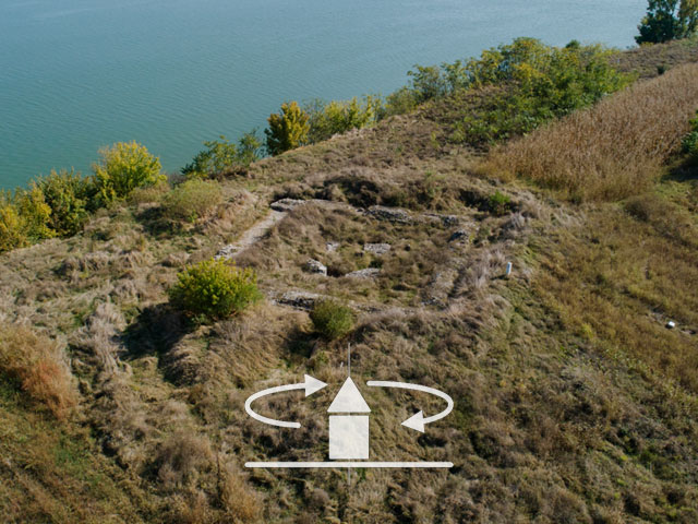
The small fortification used to be of square shape, with dimensions of 18,5 х18,5 m on the outside and 14,5х14,5 m measured on the inside, with 2m thick walls. The entrance gate was on the western rampart. In the middle of the fortress, four square columns were discovered, above which there was a watchtower which was in the upper parts probably made of wood with clay tiled roof, according to the research findings.
The outward rampart of rectangular base built in early 6th century, with the dimensions 55 х 51 m, had on the corners protruded round towers 7 -7,5 m in diameter as measured from outside or 4, 40 m inside the walls.
Roman military fortification built in the second half of the 4th century, destroyed in the 5th century during the barbaric invasion. It was restored in the early 6th century.
The ramparts of the fortification were built using the opus mixtum technique; they used hewn stone and brick of various formats, using mortar made of quicklime as the binding agent, thus making the walls extremely sturdy.
Dating
Roman military fortification built in the second half of the 4th century, destroyed in the 5th century during the barbaric invasion. It was restored in the early 6th century.
Јулка Кузмановић Цветковићархеолошкиња