Markovo kale, Vranje, Pčinj district
Markovo kale
Protected cultural monument of great significance, listed as SK 659 with the Central Registry of the Republic Institute for the protection of cultural monuments.
Markovo kaleVranje, Pčinj district
Where is it located
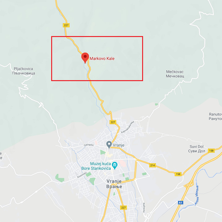
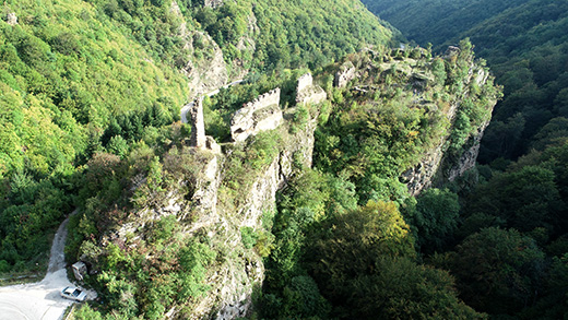
The fortress Markovo Kale is 4,5 km away from Vranje, built on a ridge 750m high, between the mountains Krstilovica and Pljačkavica, along the old road Vranje-Leskovac and current road Vranje-Vlase-Mijovci, the gorge of the Gradska river. Around the town two rivers break through the gorges, the Devotinska and Mala river, flowing into one just below the town itself.
Research
The research of the fortification was intermittently performed across the span of 10 years, between 1983 and 1994, by the Institute for the protection of cultural monuments from Niš and national Museum from Vranje. The research showed that the foundations of the fortification date from the VI century, the time of Emperor Justinian.
Dating
Vranje is first mentioned in historic sources in 1093, at the time when prefect Vukan attacked the Byzantine army. There is no data on the time when the fortress was built, but the written sources suggest it existed in the XIII century. The Turkish official inventories call it „Kale-i Ivraniya“ – Vranje fortress. Ottoman sultan Musa conquered Markovo kale in 1412. The Turks used this fortress for a while, stationing a crew of around thirty people.
Description
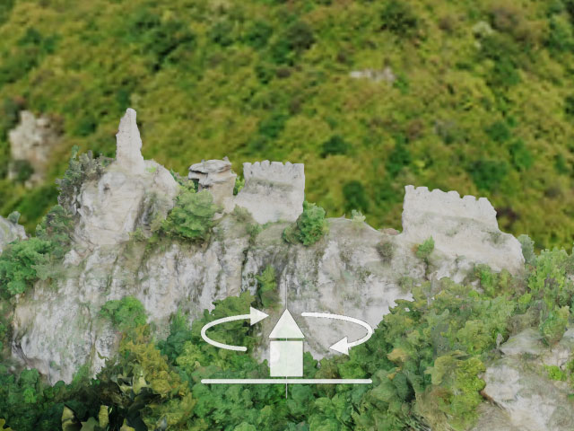
The fortification was built on the ridge between the mountains Pljačkovica and Krstilovica, high above the estuary of the Mala river into the Divotinska.
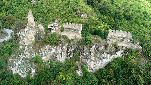
The builders also adjusted the fortress to the configuration of the terrain, so that it has a triangular base, the ramparts of the fortress follow the edges of the ridge.
Eastern and southern side of the fort are surrounded with 2 m thick ramparts, while on the western side, where the cliff is really steep, there is no rampart in fact – the cliff was defense enough.
The ramparts were built in stone bound by lime mortar; the inner and outer surface of the wall were built this way, and the middle was filled in with smaller crushed stones.
The ramparts were high and ended in prongs between which there was a walking path along the ramparts.
The entrance to the fortress in the southern wall had an access ramp. The right, eastern doorpost was preserved.
The fortress consists of upper and lower town. The upper plateau has two water cisterns, one circular and the other one with a rhomboid base. The cisterns were built next to the rampart and were used to collect and preserve rain water. Apart from the cisterns, three rooms of smaller dimensions were also discovered.
In the lower, residential area, the central spot is occupied by the church built in stone, with cross-shaped base, with three-side apse.
The remains of two towers were preserved, southeastern tower of smaller dimensions in the upper town and the dungeon tower on the northern corner, above the very road. That tower of rectangular base is well preserved in two stories high.
Folk lore and belief:
The folk lore states that Markovo Kale is the town of Kraljević Marko, hence the name. There is some belief that the fort used to be called Golubinje.
The lore says that Marko bravely defended the city from the Turks. When they overpowered him and he had to retreat, he and his horse Šarac jumped from the rock, leaving a mark, to the mountain Plačevica, which was named thus because Marko cried there. (plač=cry). Plačkovica is called Pljačkovica today. From there, he jumped to the western Krstilovica where he made the sign of the cross (krst=cross) next to the Church of Holly Trinity, today in ruins. Numerous places are related to the name of Kraljević Marko, for example a dent in the stream where he supposedly took his baths is called Marko’s furnace.
Julka Kuzmanović Cvetkovićarcheologist